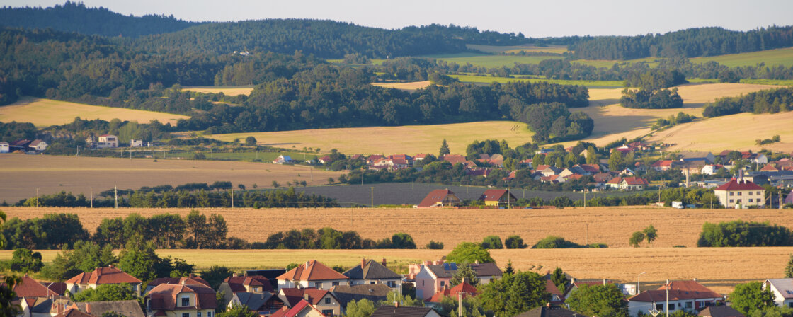
Land vs. plot
The difference between a plot and a parcel lies in their legal and registration definition. Although often used interchangeably in common parlance, they are legally distinct concepts.
Land is a portion of the earth’s surface separated from its surroundings by a legally defined boundary. It may be defined, for example, by a cadastral boundary, a property boundary, a boundary according to a zoning decision or other right recorded in the cadastre. The new Civil Code also incorporates the principle of superficies solo cedit, which states that land includes the space above and below the surface, including, for example, buildings that stand on the land.
A parcel, on the other hand, is a specific part of the land that is precisely defined, marked with a parcel number and registered in the Land Registry. It is a unit of registration in the land register. A parcel of land has clearly defined boundaries, size, location and parcel number which is crucial for property registration and proper zoning.
Thus, the difference between a plot and a parcel is that a plot is a general term referring to any part of the earth’s surface with various possibilities of legal definition, while a parcel is a specific and registered part of land with precise specifications in the land register.
Type of land – cadastre
In the Land Registry we can find information about the status that is currently valid. So if the land register states that it is a garden, for example, it is actually a garden at present. In the Land Registry, land is divided according to type into:
- Built-up areas and courtyards;
- Agricultural land, which is subdivided into: arable land, hops, vineyards, gardens, orchards and permanent grassland;
- Forest land;
- Water areas;
- Other areas
Plots are then divided into only two categories:
- Building plots: this includes land designated as built-up areas and courtyards.
- Land parcels: This includes all other types of land that are not building land (e.g. arable land, garden or forest land).
Are you solving a similar problem?
Are you planning to buy a plot of land?
We provide a complete legal service related to the purchase of the land, including a reservation contract and escrow of the purchase price. We can also help with land registry and taxes. We handle it quickly and flawlessly so you don’t have to worry about a thing. You can only pay after the service has been provided.
I want legal service
- When you order, you know what you will get and how much it will cost.
- We handle everything online or in person at one of our 6 offices.
- We handle 8 out of 10 requests within 2 working days.
- We have specialists for every field of law.
Type of land use – municipal zoning plan
How you can actually use your land is determined by the zoning plan of the municipality under which the land falls. It is a kind of plan for the future and also a permission for how the land can be used. For example, your plot of land that is registered as a garden in the Land Registry may be designated as a mixed residential area in the zoning plan.
There may be a number of ways of using the land. In addition to the use itself, the zoning plan also includes conditions that the building on the land must meet. Uses and conditions are set by the municipalities themselves and therefore vary greatly depending on which municipality you have land in.
Example of land use and conditions set out in a zoning plan
Land Use: Individual housing
Characteristics:
Areas zoned primarily for residential use, which include areas of mostly low-rise single-family homes, and may also include farm and recreational features and necessary infrastructure. These areas are intended for the construction of single-family houses and exceptionally low-rise apartment buildings (up to 2 storeys, including the possibility of loft apartments).
Principal uses:
- Single-family homes and structures immediately related and incidental to housing, as accessory structures to the principal structure;
- Public infrastructure amenities of local importance with regard to the height level of the surrounding buildings;
- Buildings and facilities for education and upbringing, social services, family care, health services, culture, public administration, public protection;
- Buildings for commerce (up to 1 000 m2 of usable area);
- Public spaces;
- Local roads of functional groups, parking areas.
Permitted uses:
- Buildings and facilities for sport, relaxation and leisure;
- Residential buildings – with regard to the height level of the development;
- Buildings and facilities for services and business activities whose negative effects on the environment do not exceed the limits specified in the relevant regulations beyond the permissible level.
Conditionally permissible use:
- Use of areas Z3/5 and Z3/16 after assessment of negative effects from traffic operation in terms of hygiene limits;
- Use of the area Z3/16 after assessment of permissibility due to the delimitation in the protection zone of roads. I/11.
Use not permissible:
- New buildings for individual recreation;
- Cemeteries;
- Buildings for commerce – large commercial facilities of multi-storey department store type;
- Buildings for livestock (except buildings for livestock breeding);
- Fuel filling stations;
- Homesteads;
- Mobile homes;
- Other structures and facilities not related to principal and permitted uses.
Conditions of spatial arrangement and protection of landscape character:
- Coefficient of greenery (KZ) – min. 0.50;
- Maximum proportion of the built-up area on the total area (built-up index) 30% and maximum height of the building in the above-ground floors 2 NP + attic;
- Buildings must respect the compositional relationships and correspond to the context and character of the surrounding buildings by the architectural structure of the building forms and especially by the total volume of the building;
You will encounter conditions on the architectural massing and appearance of the structure to be built on the property in many cases. The aim is that new buildings should be designed to blend in with the surrounding area and respect the aesthetics of the site (for example, in a rural development, flat roofs may not be permitted).
In doing so, specific ideas will vary from village to village and different conditions will apply on the edge of a village or in a town centre. In this case, it is therefore necessary to contact the municipality directly to find out what its requirements are.
Basic information about the land can be found in the Land Registry. The Land Registry is a publicly accessible register where you can find information about land, buildings and their owners. It is used to protect property rights, for tax purposes, to determine the value of real estate and to protect the environment. You can consult the cadastre free of charge – either in person at the cadastral office or conveniently online from home via the ČÚZK website.
When you preview a specific parcel, you will see:
- Parcel number and type of land (e.g. arable land, garden, built-up area);
- Area of the plot in m²;
- The cadastral area in which the plot is located;
- Owner of the property – name, surname and permanent address;
- Legal restrictions – for example, easements, liens, or executions;
- Type of ownership – sole ownership, co-ownership or community of property.
Tip for article
More information about accessing the cadastre and available information will be revealed in another of our articles.
The type of land use and conditions can be found in the municipal plan of the municipality under which your land falls. The spatial plan is the basic instrument by which each municipality determines how its territory will be used and developed – in terms of housing, transport, nature, business or technical infrastructure. It is a long-term strategic document that divides the territory into zones with different designations (e.g. residential, industrial, agricultural, recreational) and sets out rules on what can be built where and under what conditions.
The zoning plan is a public document. Most often you will find it on the municipality’s website, or it can be obtained from the municipal authority, the building authority or the regional authority.
If you are going to buy land or build on it, the zoning plan will tell you what you can do on it. For example:
- The functional use of the land – e.g. whether it is for housing, manufacturing, agriculture or as public open space,
- Whether it is a stabilised area (with no planned change of use) or an area of change where conversion is envisaged,
- Regulatory conditions for building – for example, that you can only build a family house up to two storeys with a gable roof on the site,
- The existence and location of utilities and transport infrastructure (e.g. roads, sewers, public lighting),
- The presence of public and green areas in the vicinity – e.g. park, public open space, buffer zone.
Summary
Land and parcel are not the same thing – land is a legally defined part of the earth’s surface, while a parcel is its unit of record registered in the Land Registry with a precise number, area and boundaries.
The future use of the land is determined by the municipality’s land use plan. It determines what the land can be used for (e.g. for housing, production, greenery) and under what conditions. The plan also includes rules for building, such as maximum house heights, percentage of built-up area or architectural requirements.
Information about the land can be found free of charge online in the Land Registry (ČÚZK). The method of use and regulatory conditions can be found in the municipality’s zoning plan, available on the municipality’s website or at the building office.